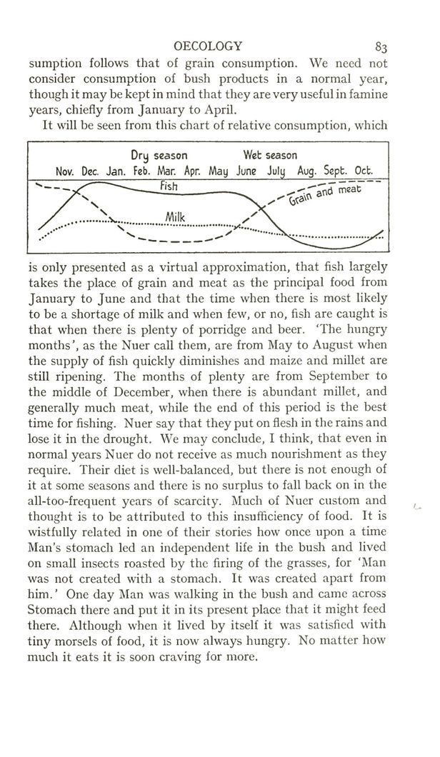
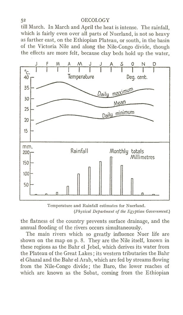
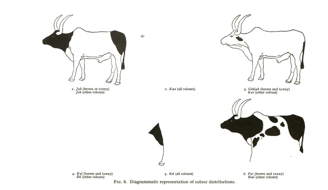
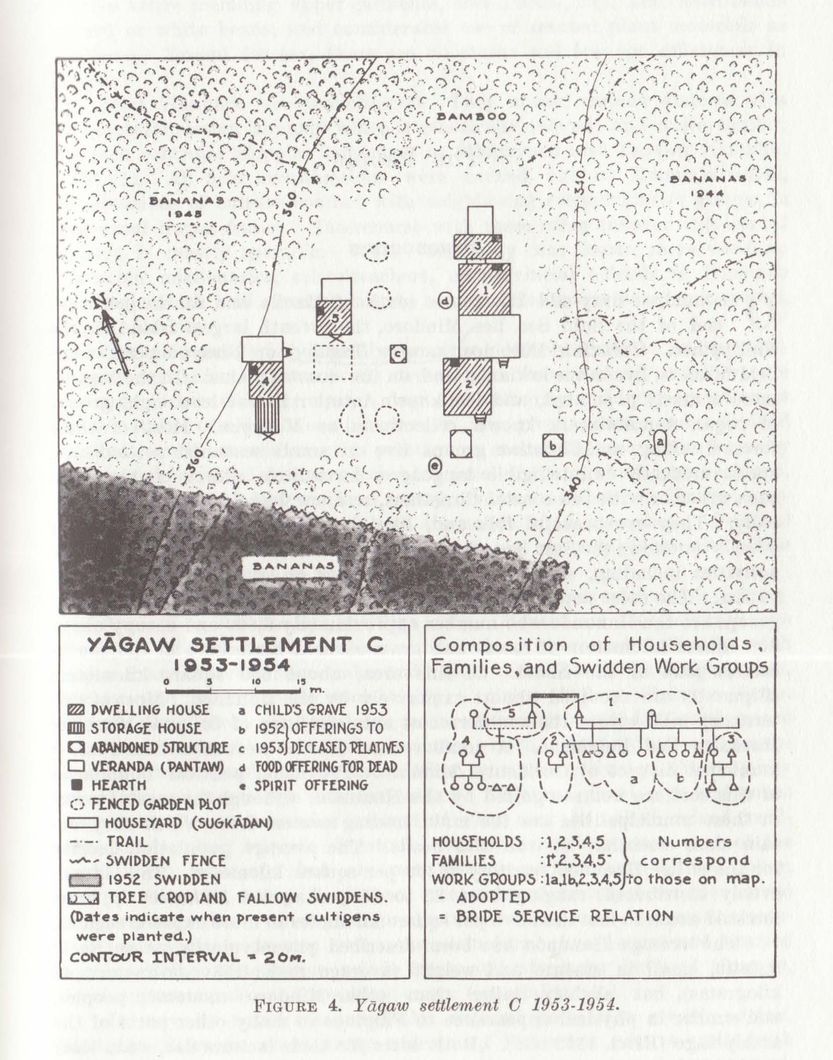
filing cabinet
Home
Archives
Search
Feed
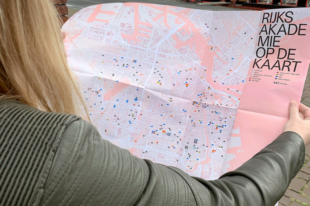
map
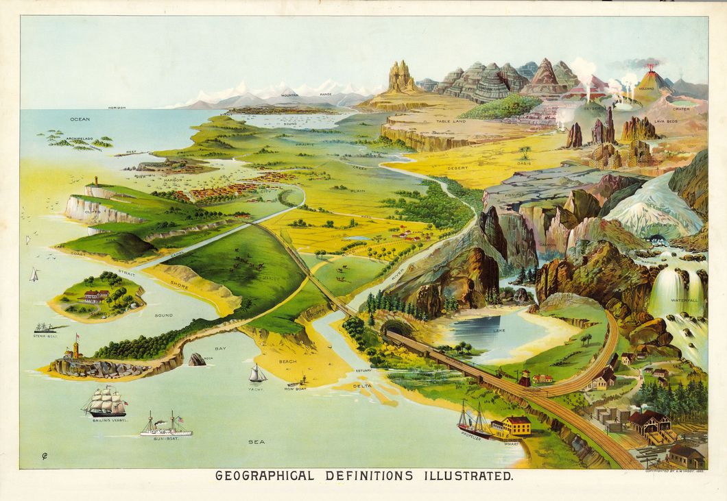
Free Amazingly Colorful Educational Geography Posters - Picture Box Blue
Added
June 27, 2022
THE MAPPING JOURNEY PROJECT-BOUCHRA KHALILI - YouTube [map] [art]
Added
October 12, 2017
Bouchra Khalili.
Added
October 12, 2017
[map] [brooklyn]
Added
September 14, 2017
how to reproject a geotiff gdalwarp -t_srs ‘EPSG:54030’ SR_HR.
Added
July 9, 2017
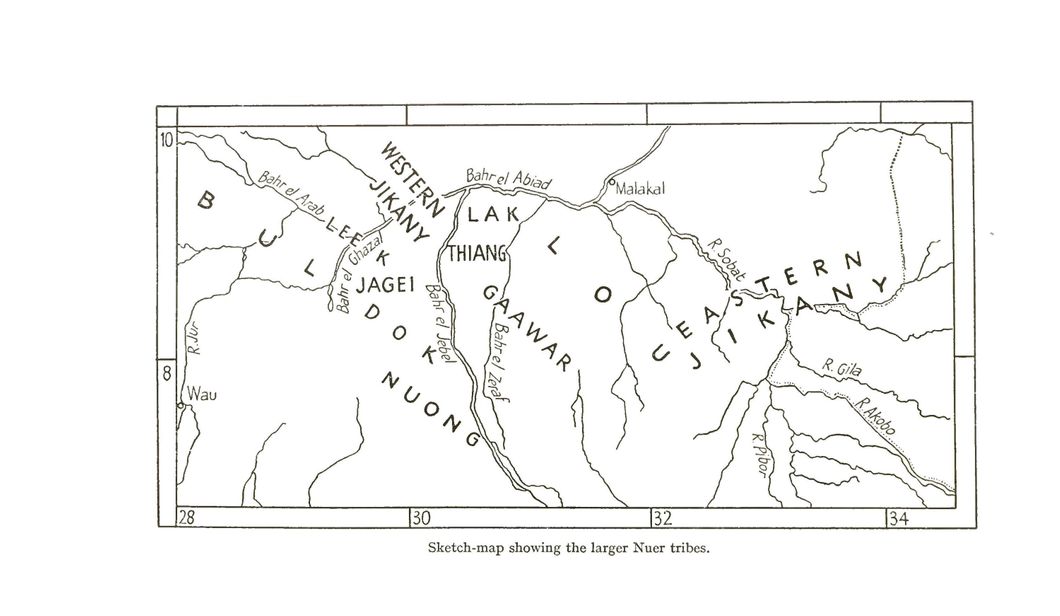
[news] [map] [graphic] [nyt]
Added
July 3, 2017


![[map] anton thomas [hand drawn] 29627157953_3eae4ddae0_k](https://cdn.blot.im/blog_d15250e095a04d02bf6a800633c910e3/_thumbnails/1507909752669/ppu-map29627157953_3eae4ddae0_k.jpg)
![moon map [map] [space]](https://cdn.blot.im/blog_d15250e095a04d02bf6a800633c910e3/_thumbnails/1507869196058/ge-0bmubz-moon20map20map20space.jpg)
![[map] [brooklyn] [new york] LB](https://cdn.blot.im/blog_d15250e095a04d02bf6a800633c910e3/_thumbnails/1505414382141/6b-map20brooklyn20new20york20lb.jpg)
![[map] [brooklyn] [new york] JB](https://cdn.blot.im/blog_d15250e095a04d02bf6a800633c910e3/_thumbnails/1505414377671/ef-map20brooklyn20new20york20jb.jpg)
![[map] [brooklyn] [new york] BOQ](https://cdn.blot.im/blog_d15250e095a04d02bf6a800633c910e3/_thumbnails/1505414372786/9-map20brooklyn20new20york20boq.jpg)
![[map] [brooklyn] [new york] BOB](https://cdn.blot.im/blog_d15250e095a04d02bf6a800633c910e3/_thumbnails/1505414368435/v-map20brooklyn20new20york20bob.jpg)
![[map] usgs [us]](https://cdn.blot.im/blog_d15250e095a04d02bf6a800633c910e3/_thumbnails/1505414363189/large-4gbvlm-map20usgs20us.jpg)
![[map] minnesota lakes](https://cdn.blot.im/blog_d15250e095a04d02bf6a800633c910e3/_thumbnails/1505414308398/ge-x9l3t1-map20minnesota20lakes.jpg)
![[map] [illustration] illustrated map of the [us]](https://cdn.blot.im/blog_d15250e095a04d02bf6a800633c910e3/_thumbnails/1505414303324/20illustrated20map20of20the20us.jpg)
![[illustration] [map] alaska](https://cdn.blot.im/blog_d15250e095a04d02bf6a800633c910e3/_thumbnails/1505414292450/mt89w-illustration20map20alaska.jpg)
![[isometric] [map] [diagram] sf geology forms](https://cdn.blot.im/blog_d15250e095a04d02bf6a800633c910e3/_thumbnails/1505414286857/ap20diagram20sf20geology20forms.jpg)
![[map] [diagram] [illustration] the sea](https://cdn.blot.im/blog_d15250e095a04d02bf6a800633c910e3/_thumbnails/1505414282170/diagram20illustration20the20sea.jpg)
![[map] Astronomy-Celestial-Atlas-Jamieson-1822-Plate-28](https://cdn.blot.im/blog_d15250e095a04d02bf6a800633c910e3/_thumbnails/1499171118301/l-atlas-jamieson-1822-plate-28.jpeg)
![[map] [color] copy](https://cdn.blot.im/blog_d15250e095a04d02bf6a800633c910e3/_thumbnails/1499170365586/large-l1wsmk-map20color20copy.jpg)
![[map] wall map](https://cdn.blot.im/blog_d15250e095a04d02bf6a800633c910e3/_thumbnails/1499170353659/large-vb2uah-map20wall20map.jpg)
![[map] [illustration]](https://cdn.blot.im/blog_d15250e095a04d02bf6a800633c910e3/_thumbnails/1499170352201/large-rx2r8o-map20illustration.jpg)
![[graphic] [map] diaspora](https://cdn.blot.im/blog_d15250e095a04d02bf6a800633c910e3/_thumbnails/1499170326878/e-mlpg8l-graphic20map20diaspora.jpg)
![[map] [transit] London : INAT metro maps](https://cdn.blot.im/blog_d15250e095a04d02bf6a800633c910e3/_thumbnails/1499137541577/it20london2020inat20metro20maps.png)
![[map] [isometric]](https://cdn.blot.im/blog_d15250e095a04d02bf6a800633c910e3/_thumbnails/1499137539019/large-s5jmj1-map20isometric.jpeg)
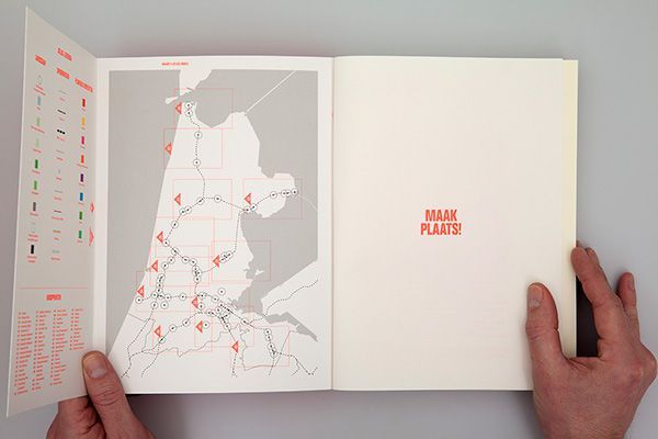
![[map] [design] Joost Grootens](https://cdn.blot.im/blog_d15250e095a04d02bf6a800633c910e3/_thumbnails/1499137537328/h-map20design20joost20grootens.jpeg)
![[map] [design] Joost Grootens (2)](https://cdn.blot.im/blog_d15250e095a04d02bf6a800633c910e3/_thumbnails/1499137535913/ap20design20joost20grootens202.jpeg)
![[map] [design] Joost Grootens (1)](https://cdn.blot.im/blog_d15250e095a04d02bf6a800633c910e3/_thumbnails/1499137534702/ap20design20joost20grootens201.jpeg)
![[map] [subway] [new york] Design Work Life » cataloging inspiration daily (1)](https://cdn.blot.im/blog_d15250e095a04d02bf6a800633c910e3/_thumbnails/1499137234481/aloging20inspiration20daily201.jpeg)
![[map] [new york] [subway] Design Work Life » cataloging inspiration daily](https://cdn.blot.im/blog_d15250e095a04d02bf6a800633c910e3/_thumbnails/1499137232908/cataloging20inspiration20daily.jpeg)
![[map] [isometric] bollmann_lg.jpg (3163×2500)](https://cdn.blot.im/blog_d15250e095a04d02bf6a800633c910e3/_thumbnails/1499137231405/tric20bollmann_lg-jpg2031632500.jpg)
![[map] [illustration] Hannah Warren’s Nordic Map Is As Striking As It Is Beautiful - The Fox Is Black](https://cdn.blot.im/blog_d15250e095a04d02bf6a800633c910e3/_thumbnails/1499137226913/iking20as20it20is20beautiful20.jpeg)
![[map] [color] [new york] [subway] Triboro’s One-Color Subway Map | September Industry](https://cdn.blot.im/blog_d15250e095a04d02bf6a800633c910e3/_thumbnails/1499137224794/20map207c20september20industry.jpeg)
![[map] [cartogram] Vintage infographics: Visualizations of American population distribution in 1930.](https://cdn.blot.im/blog_d15250e095a04d02bf6a800633c910e3/_thumbnails/1499137222527/lation20distribution20in201930.jpeg)
![[map] [cartogram] Vintage infographics: Visualizations of American population distribution in 1930. (1)](https://cdn.blot.im/blog_d15250e095a04d02bf6a800633c910e3/_thumbnails/1499137213917/lation20distribution20in201930.jpeg)
![[map] [design] [color] britains_resources_map.jpeg (1130×1500)](https://cdn.blot.im/blog_d15250e095a04d02bf6a800633c910e3/_thumbnails/1499136460961/ns_resources_map-jpeg2011301500.jpg)
![dorthy gambrell [map] [chart] [graphic] Where America's Wealthiest Suburbanites Live—and Where They Don't - Businessweek](https://cdn.blot.im/blog_d15250e095a04d02bf6a800633c910e3/_thumbnails/1499136450683/tes20liveand20where20they20don2.png)
![dorthy gambrell [map] [chart] [graphic] Where America's Wealthiest Suburbanites Live—and Where They Don't - Businessweek (1)](https://cdn.blot.im/blog_d15250e095a04d02bf6a800633c910e3/_thumbnails/1499136449294/tes20liveand20where20they20don2.png)
![[map] [transit0 Transit Maps](https://cdn.blot.im/blog_d15250e095a04d02bf6a800633c910e3/_thumbnails/1499136186915/r6-map20transit020transit20maps.jpg)
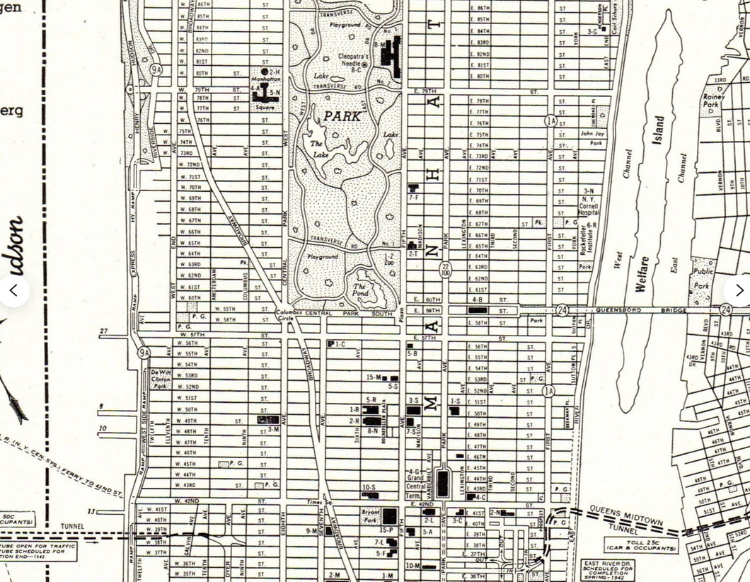
![[map] [history] [new york]](https://cdn.blot.im/blog_d15250e095a04d02bf6a800633c910e3/_thumbnails/1499136185074/wn281l-map20history20new20york.jpeg)
![[graphic] [map] [diagram] What made the mountain move - The Washington Post](https://cdn.blot.im/blog_d15250e095a04d02bf6a800633c910e3/_thumbnails/1499136178712/0move20-20the20washington20post.jpg)
![[design] [map] Mia A. Johnson (2)](https://cdn.blot.im/blog_d15250e095a04d02bf6a800633c910e3/_thumbnails/1499135573114/sign20map20mia20a-20johnson202.jpeg)
![[design] [map]](https://cdn.blot.im/blog_d15250e095a04d02bf6a800633c910e3/_thumbnails/1499115653695/large-wh9a1k-design20map.png)
![[new york] [map] [illustration] anotherone](https://cdn.blot.im/blog_d15250e095a04d02bf6a800633c910e3/_thumbnails/1499111080507/20map20illustration20anotherone.jpg)
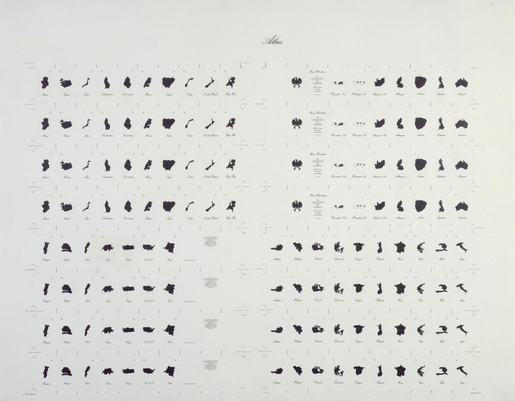
![[map] comparative lake sizes](https://cdn.blot.im/blog_d15250e095a04d02bf6a800633c910e3/_thumbnails/1499110990238/2-map20comparative20lake20sizes.jpg)
![[map] comparative lake sizes 2](https://cdn.blot.im/blog_d15250e095a04d02bf6a800633c910e3/_thumbnails/1499110985999/ap20comparative20lake20sizes202.jpg)
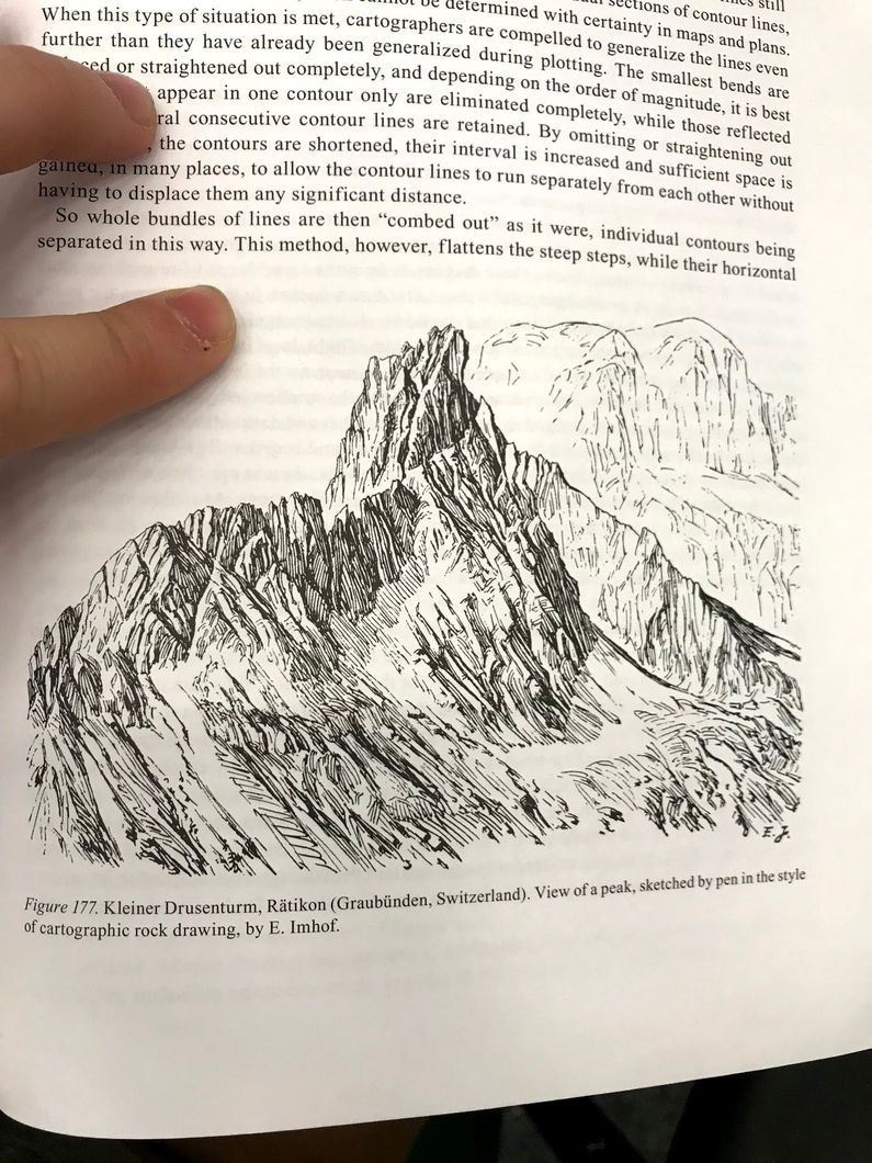
![[map] 1925 Mt Everest with Geology by Odell](https://cdn.blot.im/blog_d15250e095a04d02bf6a800633c910e3/_thumbnails/1499110980181/erest20with20geology20by20odell.jpg)
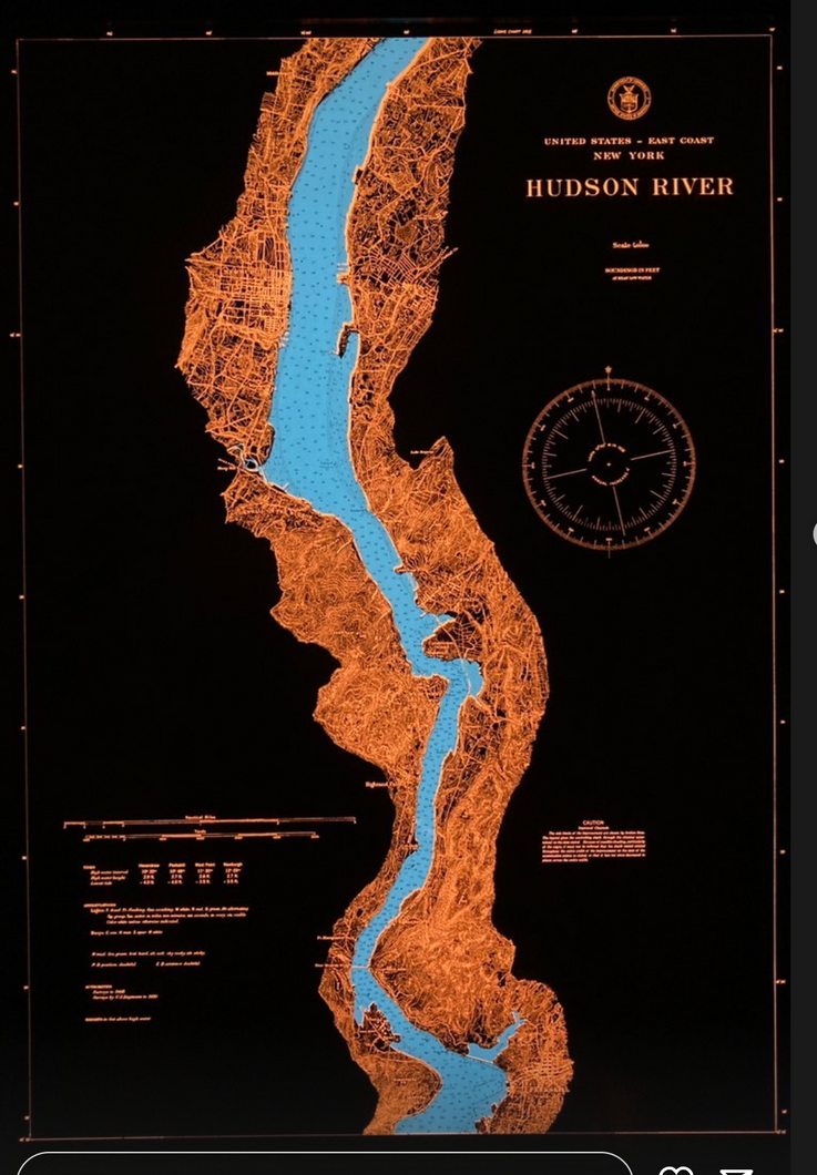
![[map] [new york] 1866_U.S._Coast_Survey_Nautical_Chart_of_Map_of_New_York_City_and_Harbor_-_Geographicus_-_NewYorkCity3-uscs-1866](https://cdn.blot.im/blog_d15250e095a04d02bf6a800633c910e3/_thumbnails/1499110976004/ap_of_new_york_city_and_harbor_.jpg)
![[map] key](https://cdn.blot.im/blog_d15250e095a04d02bf6a800633c910e3/_thumbnails/1499110962318/large-0zij3s-map20key.jpg)
![[sketch] [by hand] [map] [illustration] raisz harvard 2](https://cdn.blot.im/blog_d15250e095a04d02bf6a800633c910e3/_thumbnails/1499110235452/illustration20raisz20harvard202.jpg)
![[sketch] [by hand] [map] [illustration] raisz harvard](https://cdn.blot.im/blog_d15250e095a04d02bf6a800633c910e3/_thumbnails/1499110210172/p20illustration20raisz20harvard.jpg)
![[sketch] [by hand] [map] [illustration]](https://cdn.blot.im/blog_d15250e095a04d02bf6a800633c910e3/_thumbnails/1499110184012/ch20by20hand20map20illustration.jpg)
![[map] [color]](https://cdn.blot.im/blog_d15250e095a04d02bf6a800633c910e3/_thumbnails/1499109939307/large-vwfyfq-map20color.jpg)
![[history] [map] [new york]](https://cdn.blot.im/blog_d15250e095a04d02bf6a800633c910e3/_thumbnails/1499106696427/-9ed9e5-history20map20new20york.jpg)
![[book][design][idea][map] great idea for books:maps](https://cdn.blot.im/blog_d15250e095a04d02bf6a800633c910e3/_thumbnails/1499093700552/ea20great20idea20for20booksmaps.jpg)
![[map] languages of india](https://cdn.blot.im/blog_d15250e095a04d02bf6a800633c910e3/_thumbnails/1499034554306/3e24o-map20languages20of20india.jpg)
![[map][graphic][cartogram] us map](https://cdn.blot.im/blog_d15250e095a04d02bf6a800633c910e3/_thumbnails/1499034522364/jn-mapgraphiccartogram20us20map.jpg)
![[map][new york][brooklyn] brooklyn old map](https://cdn.blot.im/blog_d15250e095a04d02bf6a800633c910e3/_thumbnails/1499034489430/orkbrooklyn20brooklyn20old20map.jpg)
![[map] 1The Navy league map](https://cdn.blot.im/blog_d15250e095a04d02bf6a800633c910e3/_thumbnails/1499034464528/fz-map201the20navy20league20map.jpg)
![[graphic][map]](https://cdn.blot.im/blog_d15250e095a04d02bf6a800633c910e3/_thumbnails/1499034153986/large-e1c8gy-graphicmap.png)
![[map] [type] detail](https://cdn.blot.im/blog_d15250e095a04d02bf6a800633c910e3/_thumbnails/1499034003479/large-545rzu-map20type20detail.png)
![[history][map][graphic]](https://cdn.blot.im/blog_d15250e095a04d02bf6a800633c910e3/_thumbnails/1499033947140/large-h9wjxf-historymapgraphic.jpg)